Kamchatka - Land of Ice and Fire
Trekking among the volcanoes of Russia's far East
All content copyright © Ashley Burke 2015. Not to be copied, duplicated or used for any purpose without permission.
Kamchatka - Land of Ice and Fire Trekking among the volcanoes of Russia's far East
All content copyright © Ashley Burke 2015. Not to be copied, duplicated or used for any purpose without permission. |
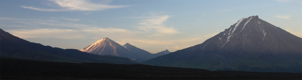
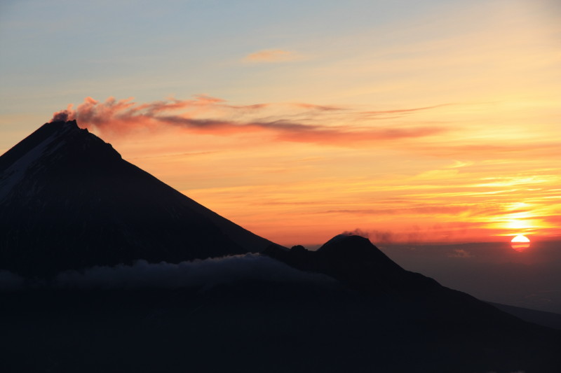
Volcanoes at sunset, Kamchatka
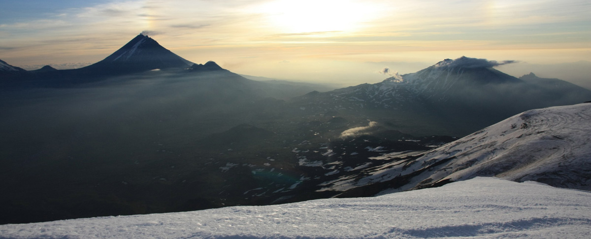
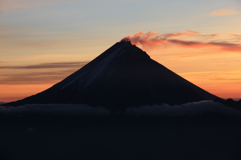
Volcanoes at sunrise, Kamchatka
Introduction
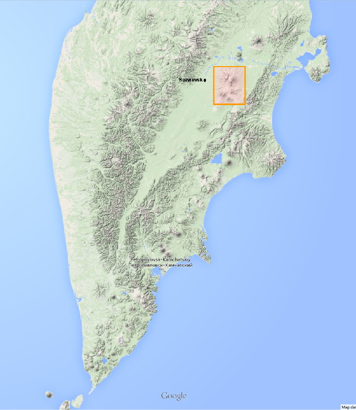 |
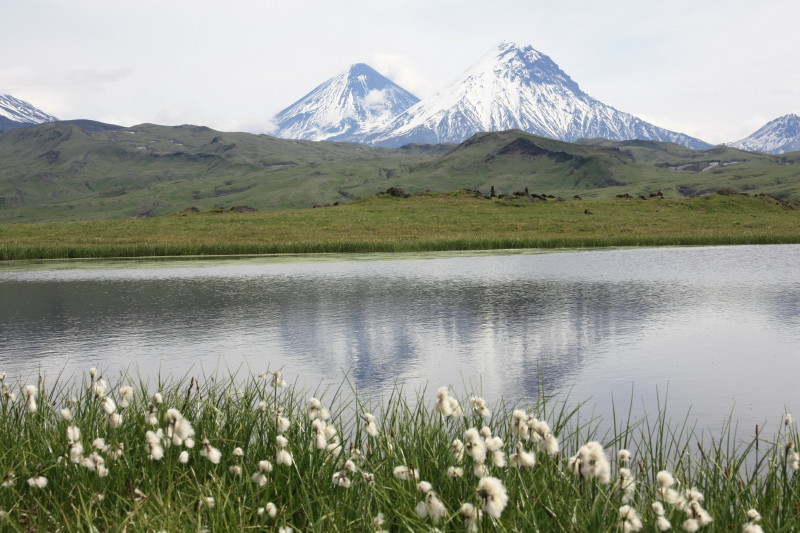
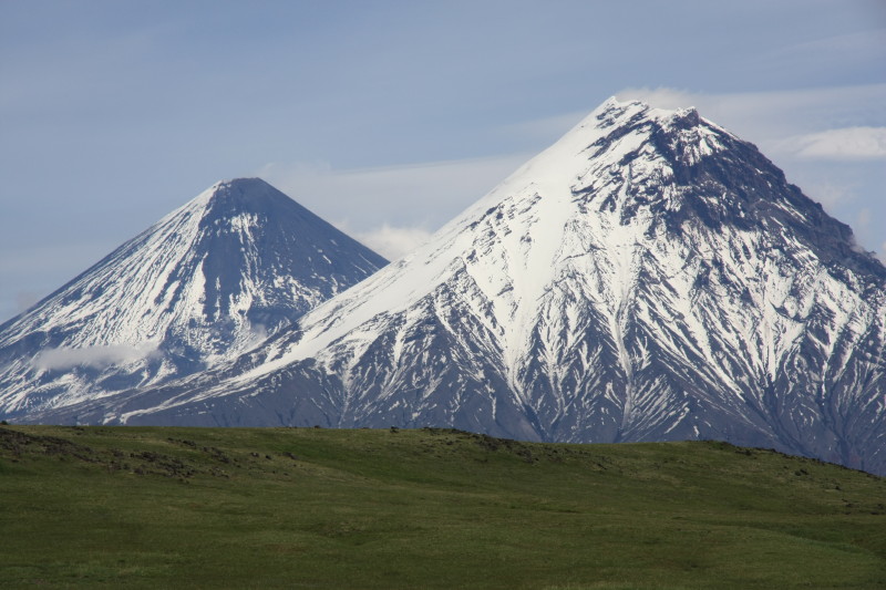
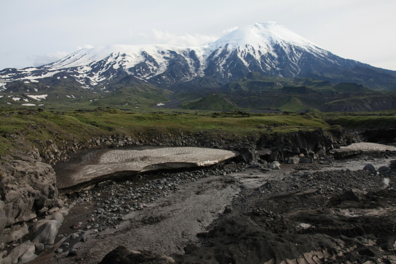
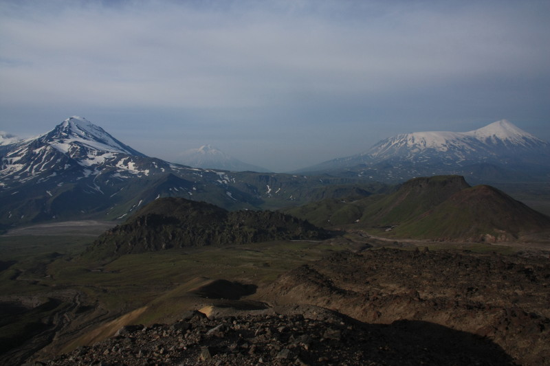
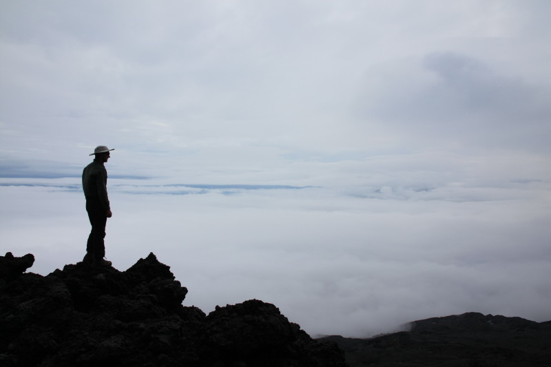
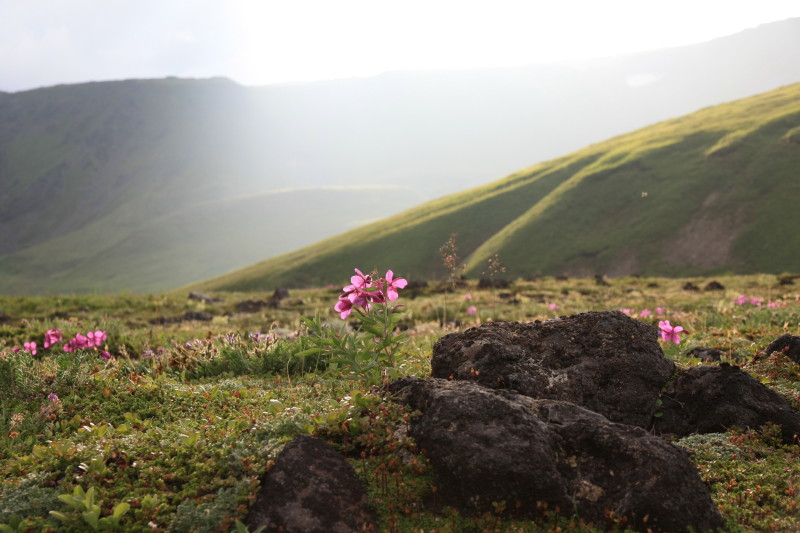
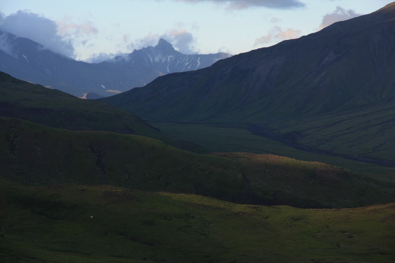
Kamchatka is the name of the large peninsula of Siberia extending southwards into the North Pacific Ocean from the Russian far East. It is located north-east of Japan. It forms part of the Pacific rim of fire and is the most volcanically active region in all of Eurasia. The principal city in Kamchatka is Petropavlovsk-Kamchatsky, a small city of around 300000 people. It is an isolated city, not connected to any other by road. No roads connect the population centres of Kamchatka to the rest of the world. The remainder of Kamchatka is very sparsely populated and is mostly wilderness. Vast areas of Kamchatka are covered in beech forest. Above about 1200m in altitude the beech forest gives way to alpine grassland. This in turn gives way to bare rock and ice from an altitude of about 2000m. You can stand on top of a volcano in central Kamchatka on a fine day and see up to 10 others, half of which have smoke coming out the top. Kamchatka is home to one of the largest wild populations of brown bears in the world. In summer it is also home to uncountable trillions of mosquitoes. That is when I was there. Kamchatka is undoubtedly one of the last great wilderness areas in the world. I want it to remain that way. |
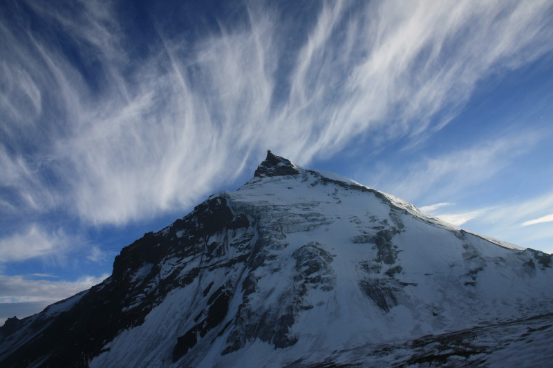
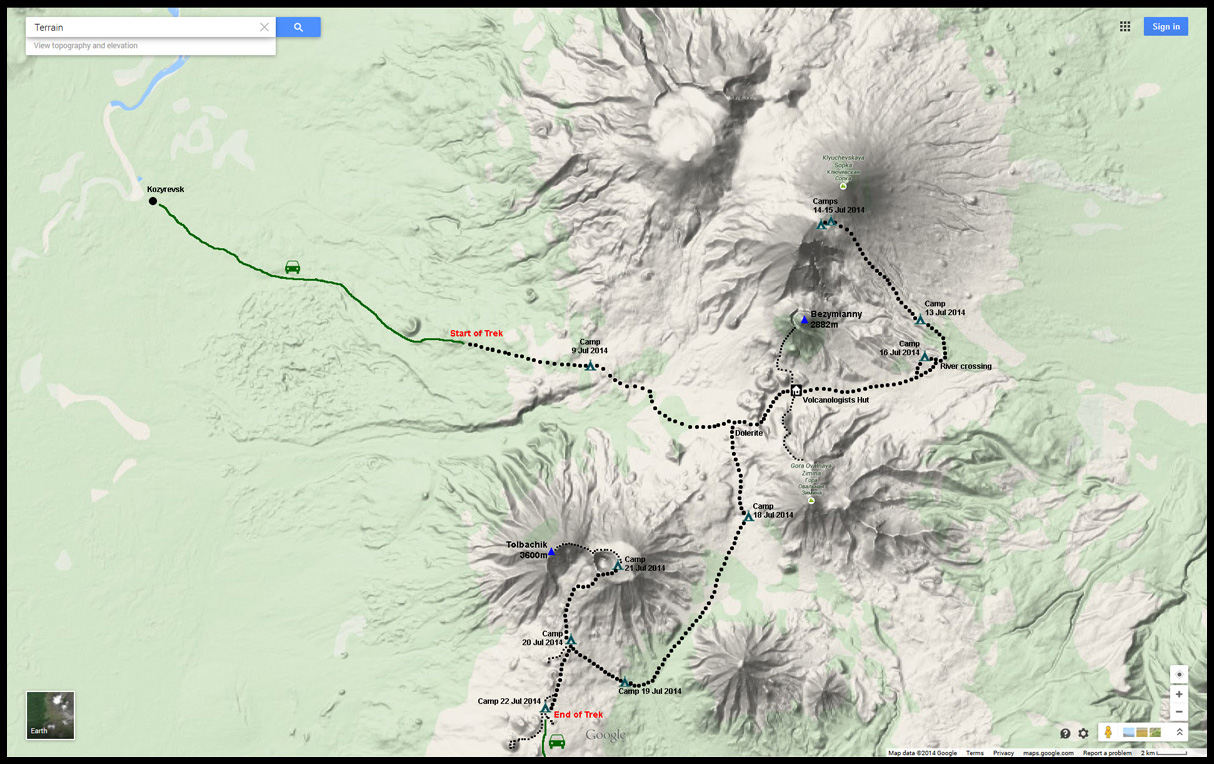
In July 2014 I joined a trekking expedition organised by Secret Compass to explore the Kluchevskaya region in central Kamchatka. This region is an elevated plateau among which are several active volcanoes including Kluchevskaya Sopka (4750m), the highest active volcano in all of Eurasia. On this trip we climbed to an altitude of 3300m on this mountain, reaching the broad pass that joins Kluchevskaya Sopka to the slightly lower and extinct volcano to the immediate south.
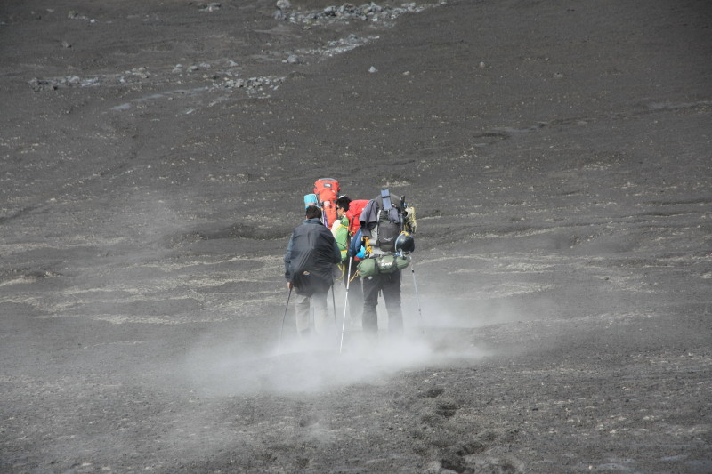
Additionally, on this 15 day trek we climbed to the crater rim of the Bezymianny volcano (2882m) which is one of the most active volcanoes in the area. We also reached the summit of the Tolbachic volcano (3600m) and climbed to about 2320m on the Zimina volcano. In the intervening time we trekked mostly above the treeline, among the alpine flowers, grassland, turbulent brown rivers, volcanic ash fields and ever-changing volcanic landscape of this geologically active region. We sighted large brown bears at least 4 times, and saw many birds and a variety of fascinating wildlife in this amazing place.
Back in Petropavlovsk-Kamchatsky we enjoyed fantastic Russian food including abundant fresh salmon caviar and fresh crab meat and of course plenty of vodka after our 15 days of trekking with packs weighing over 30kg and meagre trekking rations.
Maps
The map below shows the trekking and climbing route in more detail.
Diary
Here is my trip log. The links will take you to the relevant photos.
| Date | Comments | Accommodation |
| 6 Jul 2014 | Arrive in Petropavlovsk-Kamchatsky late in the evening after a long series of flights via Beijing and Vladivostok. | Petropavlovsk-Kamchatsky |
| 7 Jul 2014 | Met the group and prepared for the trek, sorted food rations, packed communal gear. | Petropavlovsk-Kamchatsky |
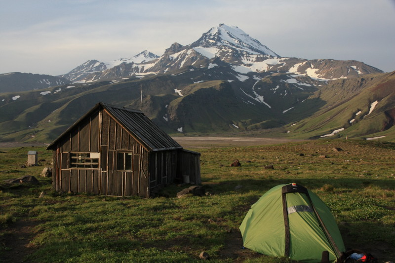
| 8 Jul 2014 | Took a public bus for the long road trip north to Kozyrevsk, a small and remote timber town on the banks of the Kamchatka River | Cabins in Kozyrevsk |
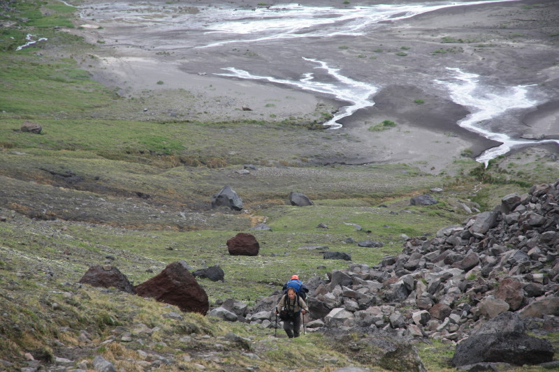
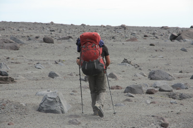
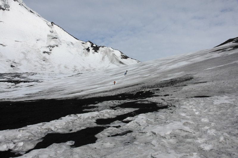
| 9 Jul 2014 | A 3 hour journey on a rough forest road in a rugged 6x6 vehicle, climbing towards the Kluchevskaya plateau. The road ended at the tree line and this was where we started our trek. Climbed steadily through open country with extremely heavy packs (30-35kg). Setup camp in open alpine grassland. Visited a small basalt canyon and a gorge with a chocolate coloured river rushing through. Lots of mosquitoes. | Wild camp |
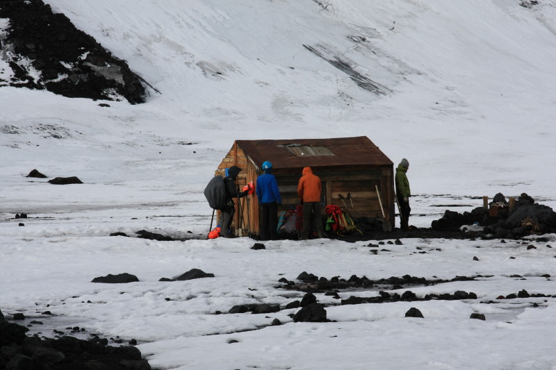
| 10 Jul 2014 | Woke to mosquito hell. Crossed a fast flowing river, brown with volcanic ash. Saw a large bear. Walked at an altitude of around 1300m. Crossed a low pass (1525m) north of the Tolbachic volcano to enter a catchment that drained to the east instead of the west. Reached a volcanologists hut at the foot of the Bezymianny volcano. | Outside the volcanologists hut |
| 11 Jul 2014 | Day trip to climb the Zimina volcano south of the volcanologists hut. This peak is over 3000m high, we reached an altitude of 2320m. We crossed a volcanic ash field and climbed a ridge onto a mountain. We saw a large brown bear who saw us and began walking towards us. We climbed until we reached the clouds, then returned to the volcanologists hut. | Outside the volcanologists hut |
| 12 Jul 2014 | Today we climbed to the crater rim of the active Bezymianny volcano (2882m) that lies to the north of the volcanologists hut. Steep and very loose climbing on the volcanic ash field. From the crater rim we gained a close-up view of the smouldering cinder cone inside the crater. Very steep and unstable ground. Returned to the volcanologists hut. | Outside the volcanologists hut |
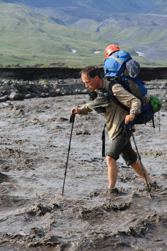
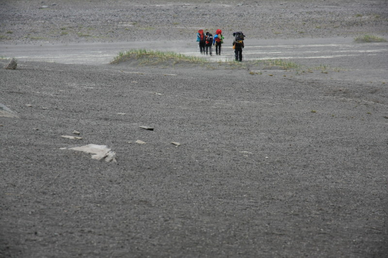
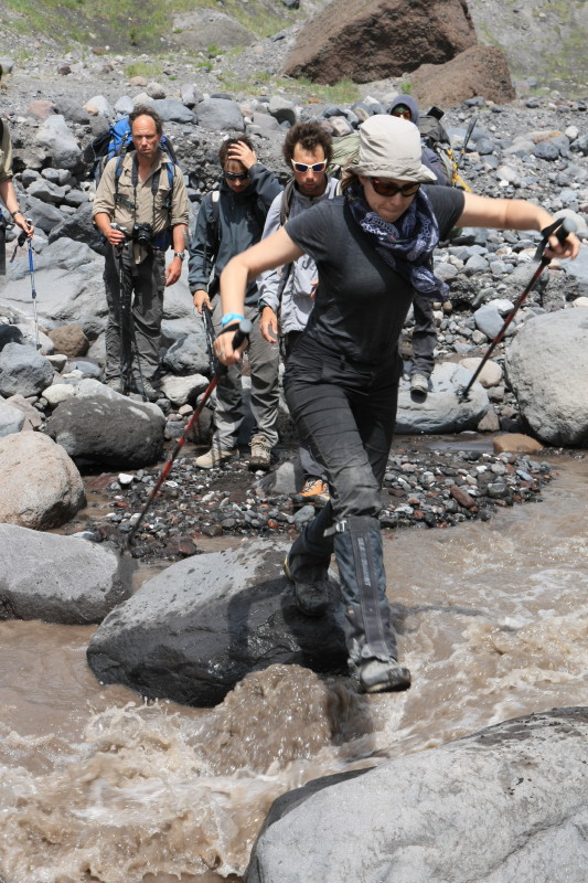
| 13 Jul 2014 | Left the hut and carrying 7 days' food headed downstream, aiming to pass around the base of Bezymianny to approach Kluchevskaya Sopka. Dusty walking through fine volcanic ash. Descended into a gorge and jumped across a chocolate coloured river. Climbed out of the gorge, began climbing towards Kluchevskaya and then camped. | Wild camp |
| 14 Jul 2014 | Got up 5:30am and began walking at 7am. A long climb up to an altitude of 3200m where we found a place to camp not far below the broad saddle to the south of Kluchevskaya Sopka. It was cloudy with a little drizzle. The terrain was gradual at first, becoming steeper and ending with some very loose traversing across the side of Kluchevskaya. Most people were pretty tired by 5pm when we stopped, hence not continuing all the way up to the pass. | Wild camp |
| 15 Jul 2014 | We completed the ascent to the pass at 3300m. This broad saddle was snowy and a small hut sat at the very top of the pass. But the slopes above us on Kluchevskaya were free of snow and were very loose with lots of falling rocks. The original aim of climbing Kluchevskaya was abandoned. It is better to climb it in early Spring, when there is still enough snow on it. So we spent most of the day around the pass, and when the weather cleared in the afternoon we climbed to 3400m for spectacular views either side of the pass. | Wild camp |
| 16 Jul 2014 | Pretty much retraced our steps of 2 days ago, heading back down from the pass. Entered cool damp cloud and continued descending in damp foggy conditions back to the chocolate coloured river which we crossed again with some difficulty. Climbed the other side and walked some distance to a camp. Somewhat damp and grubby. | Wild camp |
| 17 Jul 2014 | Retraced our steps all the way back to the volcanologists hut, reaching the hut by about lunch time. Warm and humid, we went for a much needed wash in the nearby river. Climbed the hill behind the hut for commanding views. A large bear passed through the camp in the afternoon. | Outside the volcanologists hut |
| 18 Jul 2014 | Continued retracing our steps, crossing the same low pass (1525m) we crossed on 10 July. Turned south and walked past interesting outcrops of dolerite. Spent some time among the amazing hexagonal rock structures. Climbed another low pass separating the Zimina and Tolbachic volcanoes. Saw another bear here. Continued south and camped at a mosquito infested flat area beside a wide river. In the afternoon, meltwater created a temporary stream which provided our water supply. | Wild camp |
| 19 Jul 2014 | A fine day today. Headed southwest, passing around the base of the Tolbachic volcano. Saw 2 bears today. Expansive views of wild forest. We kept above the tree line, saw a hut some distance below in the mosquito infested forest. Found a grassy shelf to camp on. A lovely stream was nearby and we went for a swim. Later, the stream became a torrent due to meltwater. Climbed a nearby hill for evening photos. | Wild camp |
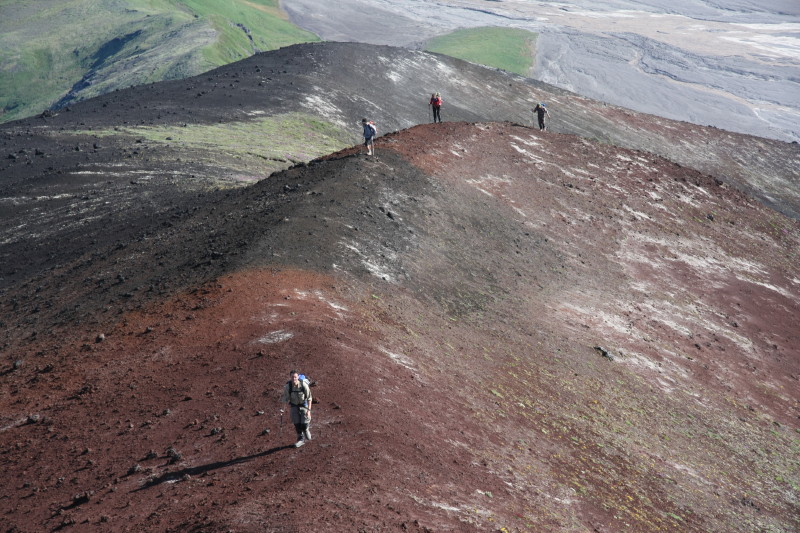
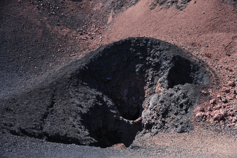
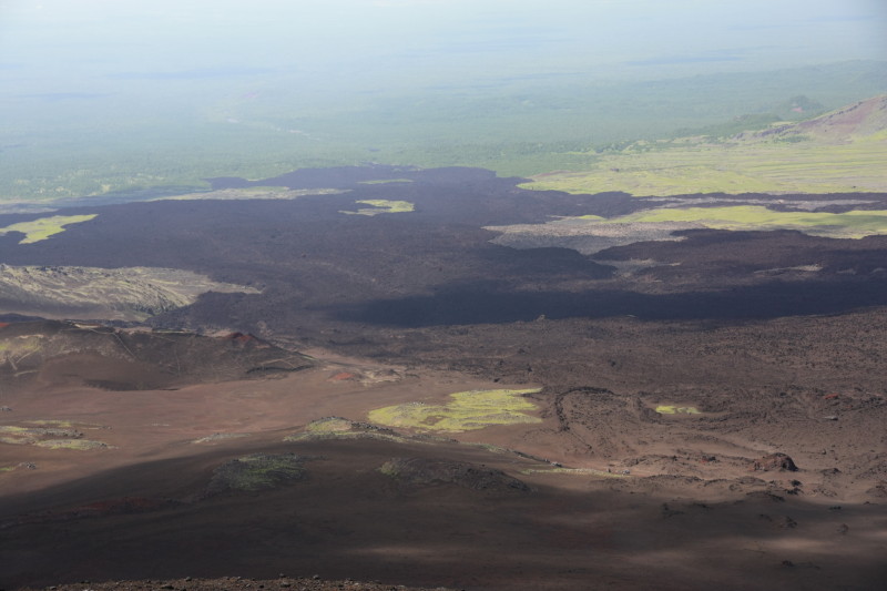
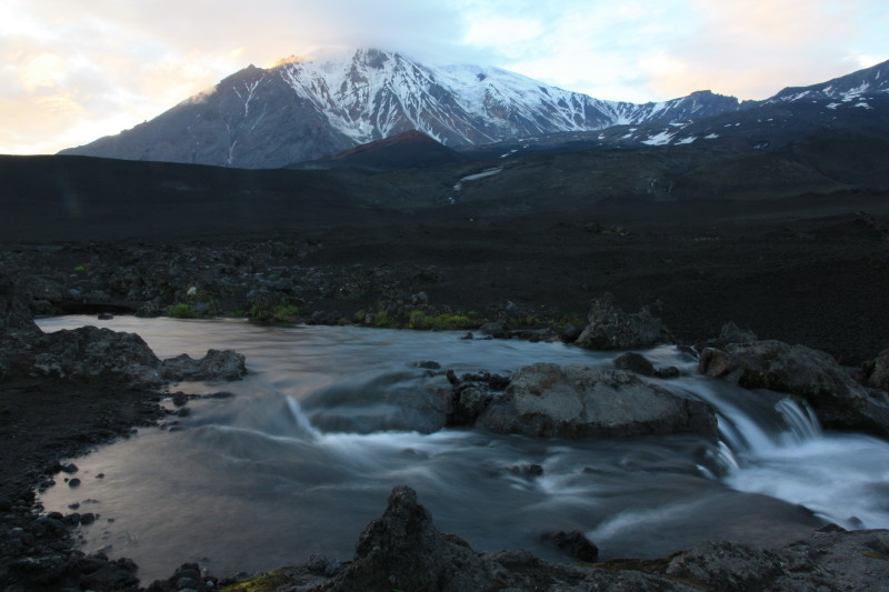
| 20 Jul 2014 | Climbed steadily until we reached a desolate rocky area on the south side of the Tolbachic volcano. Camped here in the loose rubble. A cold clear stream ran nearby. After setting up camp we headed into an area of recent volcanic activity, investigating many small volcanic craters and fissures, and heat and gases were emanating from various places in the lava. This was the aftermath of the 2012 Tolbachic fissure eruption. | Wild camp |
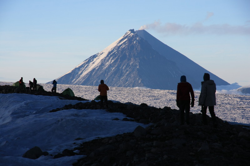
| 21 Jul 2014 | Today we climbed to the crater rim of the Tolbachic volcano and camped there at an altitude of 3000m. Fine weather for the ascent and the camp. Spectacular all day and fantastic evening views, with the smoking cone of Kluchevskaya visible. Walked around the huge wide crater of the Tolbachic volcano. | Wild camp |
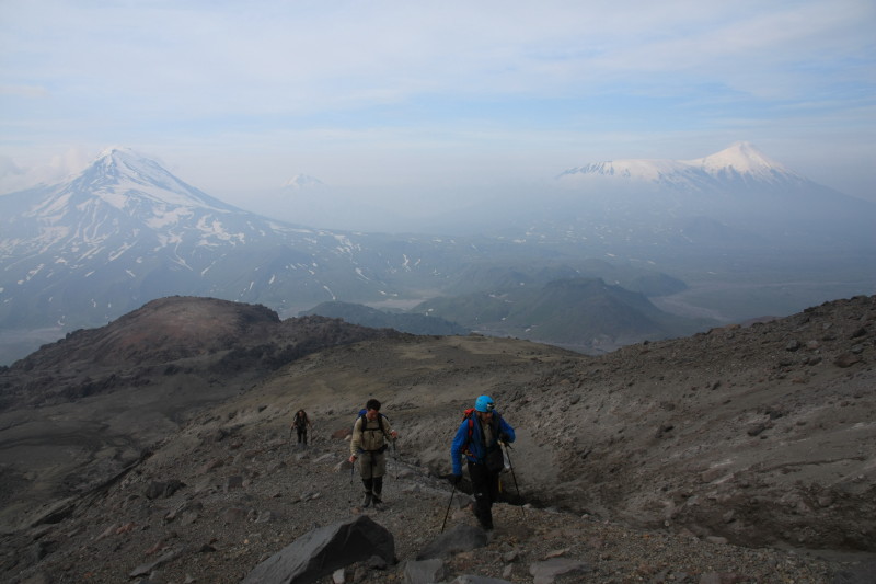
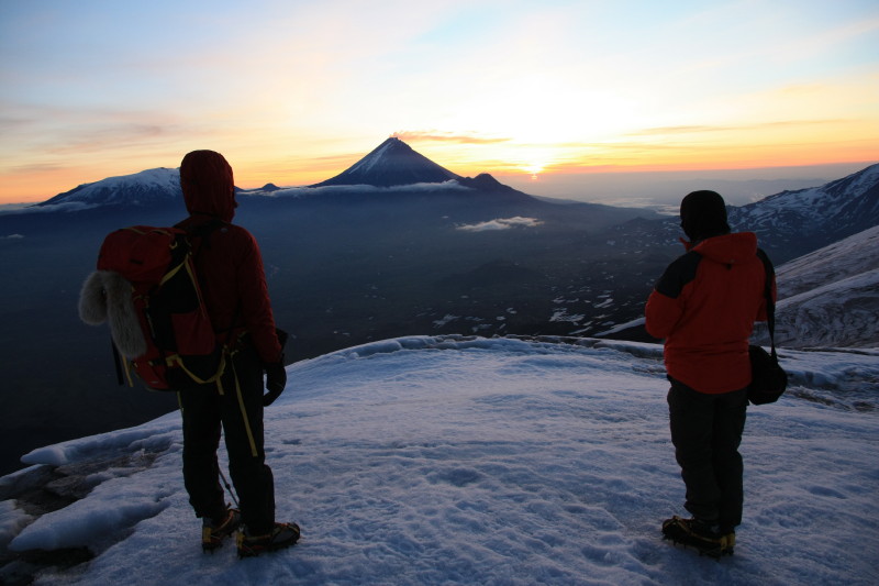
| 22 Jul 2014 | Tolbachic summit day. Alarms went off at 2:30am. While the snow was still firm we set off for the summit, walking around the crater rim to the slopes of the upper mountain. Put on crampons and climbed until sunrise. One of the best mountain sunrises I have ever witnessed. Cramponed up to the summit, reaching the summit (3600m) by 6:45am. Happy Birthday was sung on the summit. Headed back to the tents by 8:15. After some food and drink we packed up and headed down. A very long descent off Tolbachic and endless walking all the way to the road head where there were some vehicles (they had to be very rugged vehicles to make it here through the volcanic ash). We camped here. Other people were nearby. | Camp at road head |
| 23 Jul 2014 | Spare day at this not so fantastic camp site. Did a scenic day hike around the ridges behind the camp. Descended to a recent lava field and had a look. In the evening we climbed an isolated knoll for a 360 degree panorama of surrounding volcanoes. Many photos. | Camp at road head |
| 24 Jul 2014 | By prior arrangement our 6x6 vehicle arrived around 11am and we were driven back to Kozyrevsk, a very slow and bumpy drive. Enjoyed the sauna, then some fresh food and vodka, and a memorable night was had. | Cabins in Kozyrevsk |
| 25 Jul 2014 | The bus back to Petropavlovsk-Kamchatsky left around 11:45 so we had a slow morning. Weather was beginning to change, summer was ending. We arrived in Yelizovo around 6:30pm and after a shower went out for a feast at a local guest house and then went on to party and drink vodka. Some of the best food I've ever eaten. | Petropavlovsk-Kamchatsky |
| 26 Jul 2014 | Flight to Vladivostok and 1 night in Vladivostok before connecting flights home via Tokyo. |
Photos
Here are a few photos of this rarely visited and off the beaten track wilderness area.
Web page created 1 Mar 2015, last updated 1 Mar 2015. All content copyright © Ashley Burke 2015. Not to be copied, duplicated or used for any purpose without permission. |