An Ascent of Mont Blanc, France, August 2002
[Return to Ashley's home page]
Mont Blanc is the highest mountain in western Europe and towers over the valley of Chamonix in France. In August 2002 I joined a Guiding Light Mountain Guides expedition to climb Mont Blanc from the village of Les Houches, which is located a few kilometres down the valley from Chamonix.
The summer of 2002 was notorious for long periods of bad weather, and when I arrived in Les Houches and met my group of would be hopeful English climbers, it was raining steadily and the village camp ground was a waterlogged quagmire. The group I joined had already been there a week and in true English tradition were lamenting the weather they had been experiencing. I had spent the previous 3 weeks in Corsica on the GR20 trek enjoying hot Mediterranean weather, but it didn't take me long to despair of the saturating conditions that the Alps were then experiencing. If the weather stayed like this we would have no hope of climbing Mont Blanc.
Yet a few days later the weather did a complete turnaround. A long spell of at least a week of glorious cloudless skies and no wind made for perfect conditions for our climb. Below are a collection of my photos from this fantastic 4 day climb to the summit of Mont Blanc and back.
From Les Houches it is possible to get a cable car and then a railway from the valley floor to an altitude of 2372m. However a few of us purists were keen to climb all of Mont Blanc, from the valley floor to the summit and back to the valley floor again. We ingored the cable car and railway, and set off a bit earlier than the others to get a head start.
The photos below are taken after the first day of climbing from Les Houches. They cover the ascent of the mountain itself from Tête Rouse to the summit and back to Tête Rouse. This was all above the snow line and was the most spectacular part of the climb.
All photograhphs are copyright © Ashley Burke 2007. Duplication of images on this page is not permitted without the author's permission.
Day 1 - Photos from the camp on Tête Rouse.
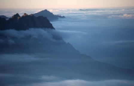
![]() From our camp site on Tête Rouse on Day 1 we admired the surrounding scenery.
From our camp site on Tête Rouse on Day 1 we admired the surrounding scenery.
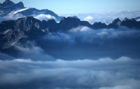
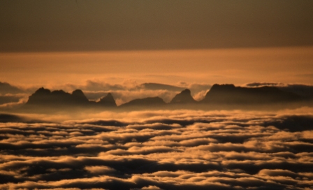
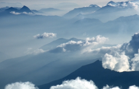
![]() A layer of cloud blankets the valleys on the evening of Day 1.
A layer of cloud blankets the valleys on the evening of Day 1.
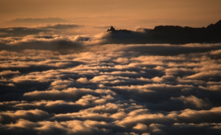
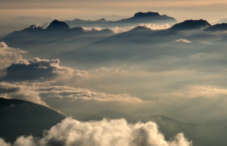
![]() The setting sun lights the valley mist.
The setting sun lights the valley mist.
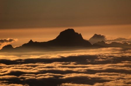
![]() Sunset.
Sunset.
![]() Sunset.
Sunset.
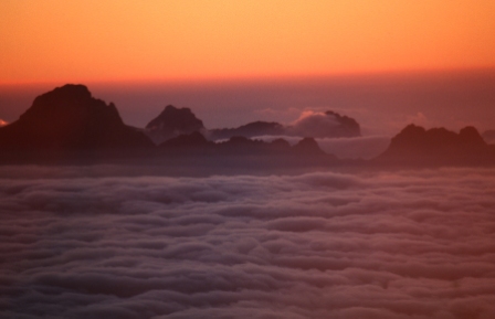
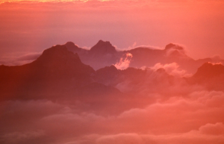
![]() The Alps in the evening light.
The Alps in the evening light.
![]() Sunset.
Sunset.
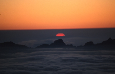
![]() Finally, the sun really does set.
Finally, the sun really does set.
Day 2 - Photos from the ascent of Goûter Ridge and from Camp 2
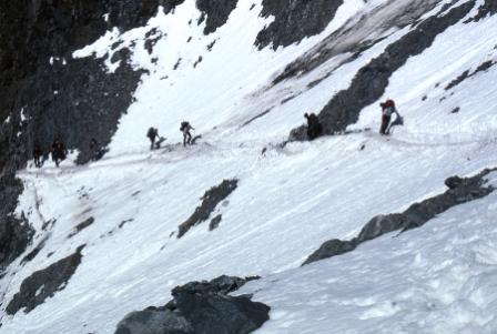
![]() Crossing "The couloir" is the most dangerous part of the climb due to the danger of avalanche and falling rocks. We did this traverse in the morning of Day 2 in order to reach the bottom of Goûter Ridge.
Crossing "The couloir" is the most dangerous part of the climb due to the danger of avalanche and falling rocks. We did this traverse in the morning of Day 2 in order to reach the bottom of Goûter Ridge.
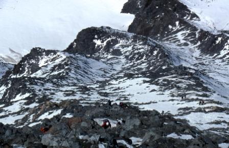
![]() Climbing up the Goûter Ridge.This ridge was a jumble of loose rock and snow, We were roped up to eachother which made climbing awkward, as the rope kept getting caught among the rocks or under our cramponed feet. The ridge was incredibly crowded and it was difficult filing past climbers coming down, overtaking slow ones going up, or just getting stuck in the queue.
Climbing up the Goûter Ridge.This ridge was a jumble of loose rock and snow, We were roped up to eachother which made climbing awkward, as the rope kept getting caught among the rocks or under our cramponed feet. The ridge was incredibly crowded and it was difficult filing past climbers coming down, overtaking slow ones going up, or just getting stuck in the queue.
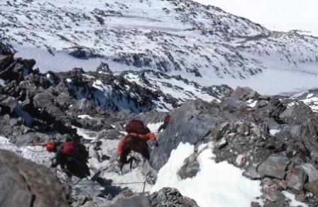
![]() Climbing up the Goûter Ridge.
Climbing up the Goûter Ridge.
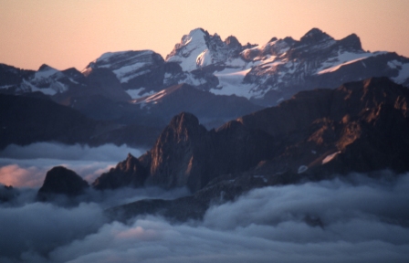
![]() From the tent site at the top of Goûter Ridge the views are spectacular.
From the tent site at the top of Goûter Ridge the views are spectacular.
![]() Below is valley haze but up here all is cool and clear.
Below is valley haze but up here all is cool and clear.
![]() Later in the evening the light changes.
Later in the evening the light changes.
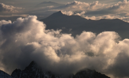
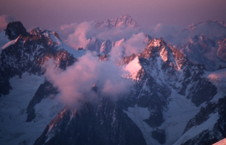
![]() Late afternoon cloud.
Late afternoon cloud.
 |
![]() More views from the Goûter camp.
More views from the Goûter camp.
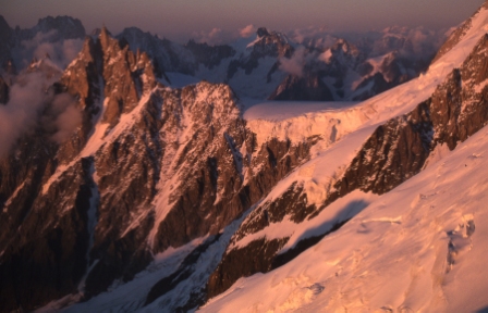
![]() View across to the Aiguille du Midi.
View across to the Aiguille du Midi.
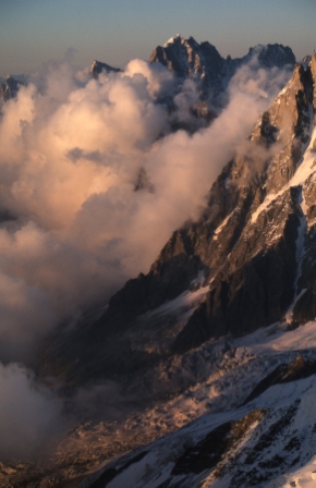
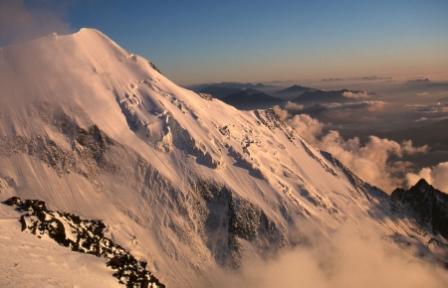
![]() Majestic mountain scenery.
Majestic mountain scenery.
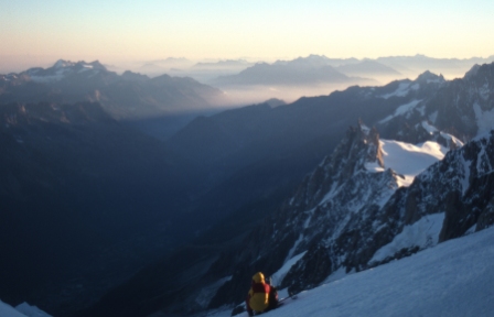
![]() This is my favourite photo from the climb. You may notice that this photo forms the background image to my home page.
This is my favourite photo from the climb. You may notice that this photo forms the background image to my home page.
Day 3 - Summit Day
On summit day, we left our Goûter camp site at 1am and climbed as far as Refuge Vallot (4362m) in complete darkness, using head torches and the stars for illumination. After reaching Refuge Vallot we waited until it became light and then continued our climb.
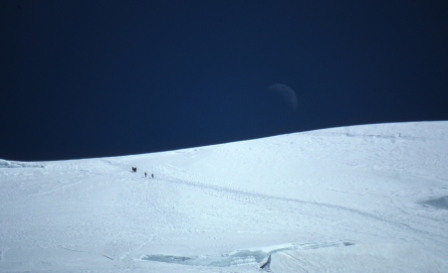
![]() This photo shows the route above the Goûter camp. We did this part of the climb at night. This photo was taken later the following afternoon and shows another group of climbers descending. A crescent moon is in the background.
This photo shows the route above the Goûter camp. We did this part of the climb at night. This photo was taken later the following afternoon and shows another group of climbers descending. A crescent moon is in the background.
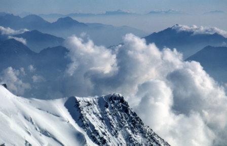
![]() The sun was rising when we left Refuge Vallot en route to the summit, revealing a spectacular scene. This photo shows the Aiguille du Midi and beyond.
The sun was rising when we left Refuge Vallot en route to the summit, revealing a spectacular scene. This photo shows the Aiguille du Midi and beyond.
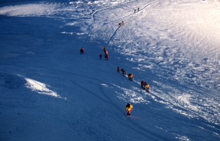
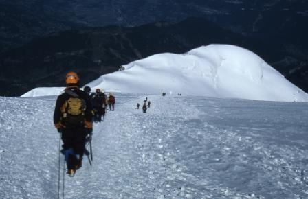
![]() Above Refuge Vallot the ridge is broad and easy to climb. This photo looks back down the slope towards Refuge Vallot showing other climbers on their way up.
Above Refuge Vallot the ridge is broad and easy to climb. This photo looks back down the slope towards Refuge Vallot showing other climbers on their way up.
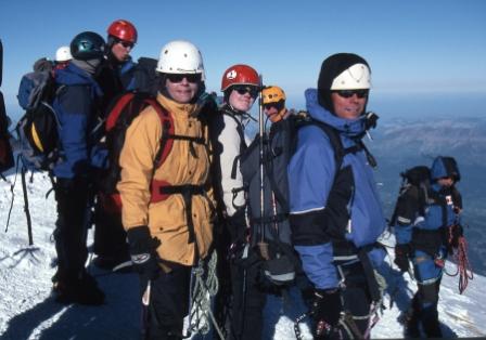
![]() The group on the summit of Mont Blanc.
The group on the summit of Mont Blanc.
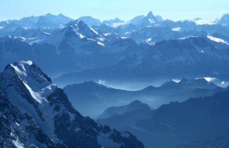
![]() The view into Switzerland from the summit of Mont Blanc.The Matterhorn can be seen as a distinctive peak on the centre right.
The view into Switzerland from the summit of Mont Blanc.The Matterhorn can be seen as a distinctive peak on the centre right.
![]() Descending from the summit.
Descending from the summit.
[Return to Ashley's home page]
End of web page.
All photograhphs are copyright © Ashley Burke 2007. Duplication of images on this page is not permitted without authors' permission.