![]()
Pantoneys Crown and Point Cameron 3 Day Hike
A challenging, spectacular and rewarding 3 day walk in the Gardens of Stone National Park
Led by Ashley Burke
Pantoneys Crown and Point Cameron 3 Day Hike A challenging, spectacular and rewarding 3 day walk in the Gardens of Stone National Park
Led by Ashley Burke |
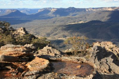
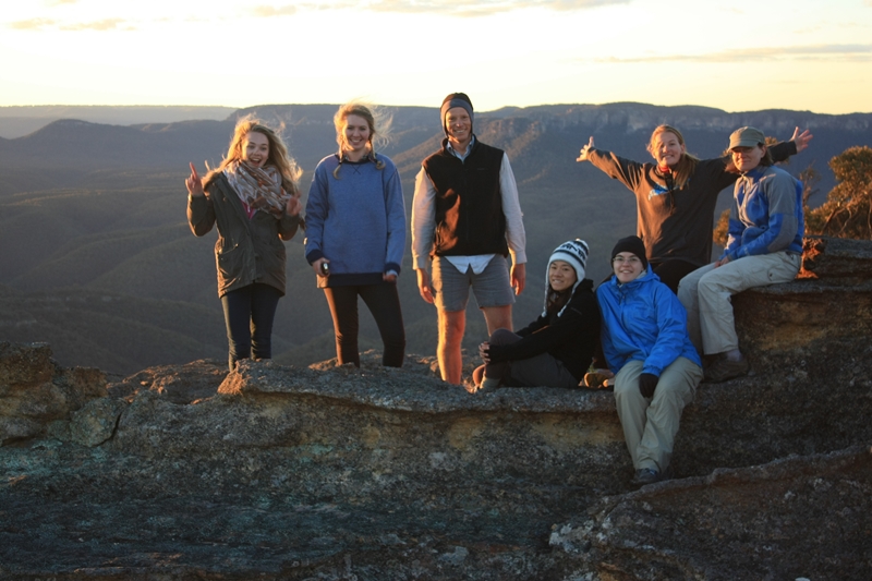
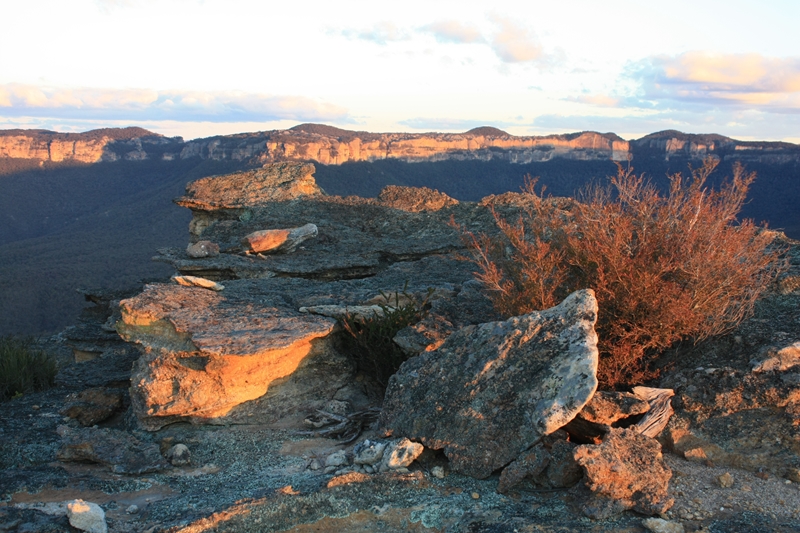
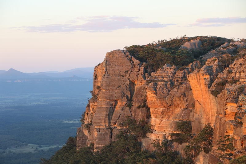
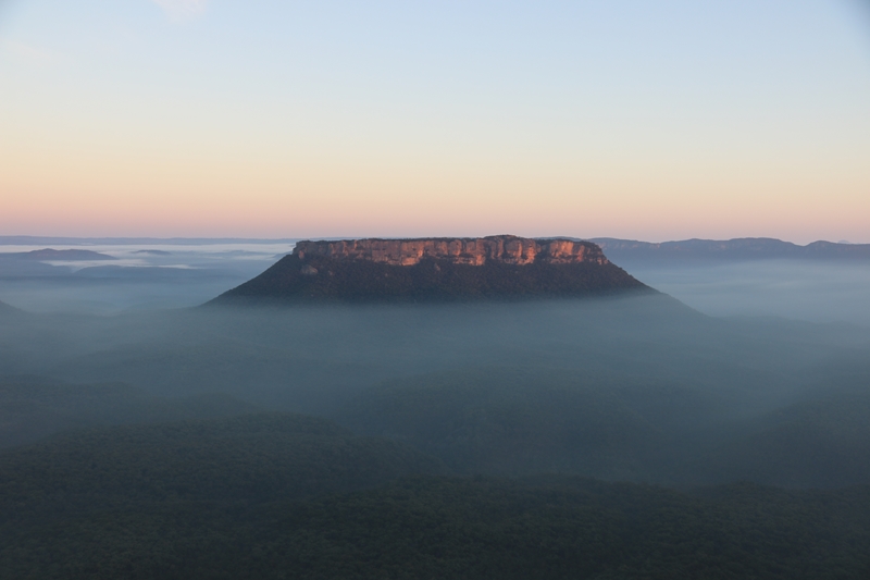
View of Pantoneys Crown from Point Cameron at sunrise
About the Pantoneys Crown Trip
|
Pantoneys Crown is an isolated plateau in the heart of the Gardens of Stone National Park. It is a dominant landscape feature within the Capertee Valley, a wide walled valley on the western side of the Blue Mountains north of Lithgow. Due to its isolated aspect, Pantoneys Crown appears as a prominent sandstone outcrop, seemingly rimmed on all sides by impassable cliff line. There is no easy route up or down Pantoneys Crown. However, with very steep clambering and rock scrambling it is possible to ascend the southern end and descend the northern end of this 1.3km long plateau. This makes it possible, though challenging, to complete a hike that ascends the southern end, traverses the summit plateau and descends the northern end in a single through trip. When you add to this the steep and spectacular ascent of Point Cameron on the escarpment of the Capertee Valley, you have an unbeatable 3 day hiking adventure. On MountainSphere's guided Pantoneys Crown and Point Cameron hike we approach the area via Ben Bullen State Forest to the south, where you can drive on very rough trails to the crest of the Great Dividing Range at the very edge of both the Wolgan and the Capertee Valleys. From here we start the hike, passing through Baal Bone Gap, then following the escarpment of the Capertee Valley to Baal Bone Point, then descending steeply to a broad saddle before tackling the climb of Pantoneys Crown proper. We climb the Crown from the south side and then camp on the summit plateau with spectacular views. On the second day we traverse the summit plateau, descend the northern end of the Crown, then cross Crown Creek. A long climb and more very steep scrambling brings us to Point Cameron where we camp the second night. On the final day a spectacular traverse of the Wolgan-Capertee Divide brings us to McLean's Pass from where we can hike back to the cars, possibly with a side trip to Cape Horn for more spectacular views into the Wolgan Valley. It is by any measure a difficult hike, with several very steep and challenging ascents and descents to be made. In some places rope and belaying may be used to ensure you are safely protected on the most exposed sections. Serious clambering up steep passes is required, although the grade of the climbing is below what would be classified as true rock climbing. Another major challenge is the need to carry most of our water with us, as at each campsite there is no water nearby. The only guaranteed water filling point is in Crown Creek on the middle day, and so large parts of the route need to be hiked whilst carrying up to 4 litres of water. The reward is the privilege of hiking a little known route, and some of the most scenic and spectacular hiking anywhere in Australia. A trip to Pantoneys Crown and Point Cameron is a rare and unforgettable experience, one of the best trips anywhere. |
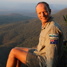 |
My first ascent of Pantoneys Crown was in 1985 on a day hike where we ascended and descended the northern end. Since then I have visited Pantoneys Crown on multiple occasions over the years, with memorable trips there in 2000, 2008, 2012, 2013 and 2018. The combination of Pantoneys Crown and Point Cameron in a single 3 day trip is a route I began taking in the later years, and I found it to be the most challenging, rewarding, satifying and complete of all the route options that incorporate Pantoneys Crown. I have been leading bushwalks, first through the Sydney University Bushwalkers and later through my own business, for around 35 years. In my formative years I had the privilege of being introduced to Blue Mountains bushwalking by people who inspire me, and through my guiding services I hope to awaken the same spirit in others that was awoken in me so many years ago. I do this by more than just taking people on organised bushwalks. I aim to pass on my skills and knowledge using a practical and inclusive teaching style. I teach the empowering skill of bush navigation through my regular navigation training weekends and am happy to provide follow up training on my guided bushwalks including the Red Rocks hike, Pantoneys Crown hike and others. My aim is not to simply take you on a bushwalk or to perpetuate your dependency on having a guide. Rather, by offering trips like this challenging and inspiring walk, I hope to provide you the security of knowing you are safely led by an experienced guide, whilst at the same time passing on to you the skills that will enable you to gain the confidence to become independent and self reliant in the future. I want to provide you a pathway that will help you regard the bush as your home, the place you go for solace, to get away from it all, to build friendships old and new, and to learn self reliance and confidence. You will do this in a friendly environment, in the company of like-minded people who are here for all the same reasons you are, in a spirit of mutual respect and friendship. Ashley Burke |
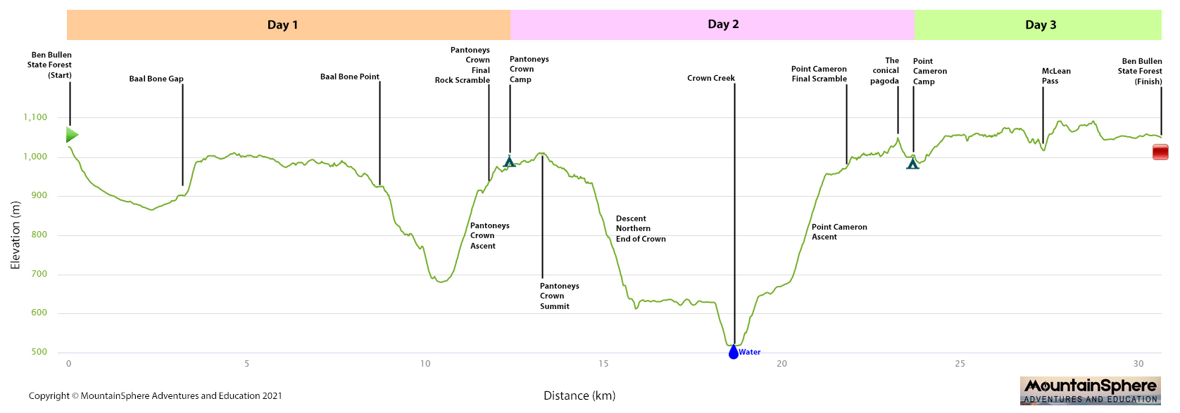
The Pantoneys Crown trip is held over 4 days, with the first of those days being the drive to the starting point for the hike. The remaining 3 days and 2 nights are hiking days, with the aim being to return to the cars by lunch time or early afternoon on the final day.
Here is a day-by-day itinerary for the guided hike.
| Day | Total Distance | Total Ascent | Total Descent | Itinerary | Campsite |
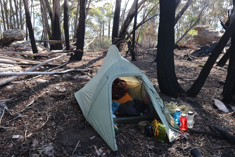
| Day 1 (Thursday) | Clients travel by their own arrangements to Lithgow. At Lithgow we will pool into at most 2 4WD or AWD vehicles for the remainder of the journey. From Lithgow it is a 19km drive on good road to the start of the rough dirt road in Ben Bullen State Forest which we then drive along for a further 9km to a fork in the trail where we park the cars and camp. We would aim to meet in Lithgow at about 2:30pm. This will allow time to car pool, drive to the start, and setup camp in the daylight Clients arriving by 2WD vehicle will leave their car in Lithgow and transfer to a 4WD or AWD vehicle for the drive into camp. We will camp by the cars that evening. |
By the cars in Ben Bullen State Forest | |||
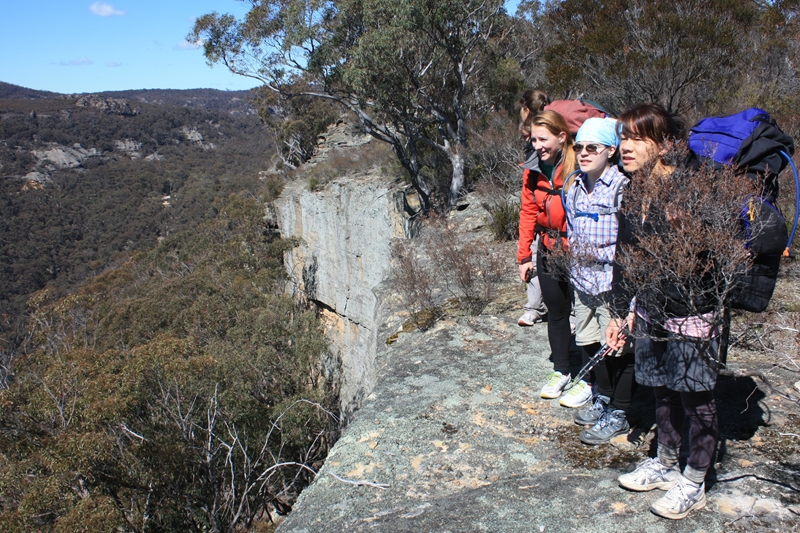
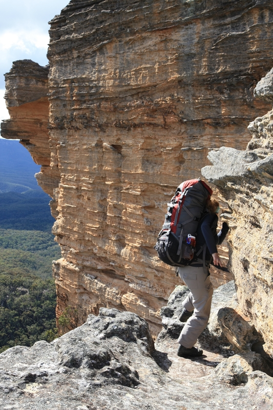
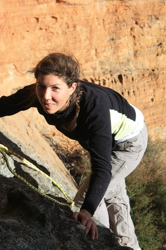
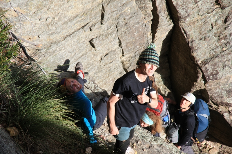
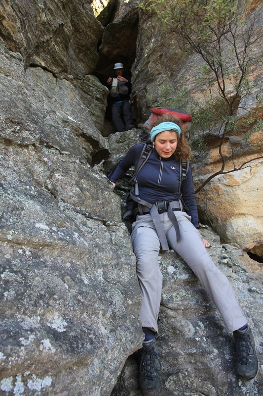
| Day 2 (Friday) | 12km | 600m | 600m | This is a challenging day of hiking and an early start is needed. We may rise before first light, have breakfast, pack up tents, and then start the hiking as the sun rises. The hike initially is to continue north along the rough dirt road in Ben Bullen State Forest. A steep and gravelly descent is needed, and care must be taken here. We follow fire trails around to Baal Bone Gap where we can collect water from a pressure reducing station. This is the last water for the entire day and possibly the night and so from here we must walk with all our water bottles full – 4 litres of water per person. We climb onto the escarpment and hike gentle ridges with spectacular views along the rim of the Capertee Valley all the way to Baal Bone Point. We may have an early lunch here. It is a very steep descent off Baal Bone Point and rope may be needed. This takes us into a broad low saddle that separates Pantoneys Crown from the walls of the Capertee Valley. The final task of the day is the very steep ascent of Pantoneys Crown itself. This is a long steep climb followed by a rock scramble through the cliff lines to reach the summit plateau. Rope and harnesses may be used here. The climbing is exposed and challenging. Once on top we enjoy spectacular views, and nearby is a beautiful spot to camp. We watch the sunset from atop nearby cliffs. |
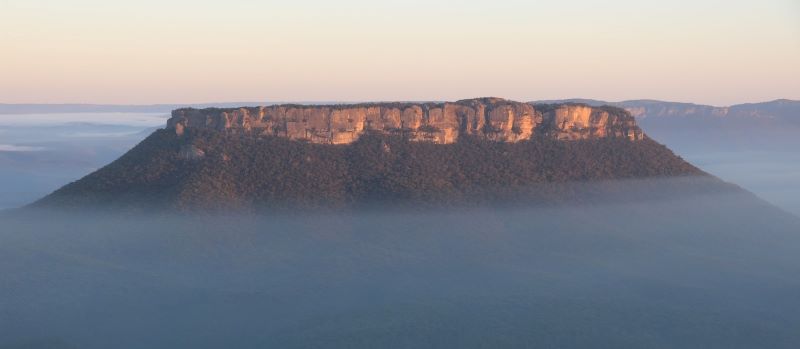
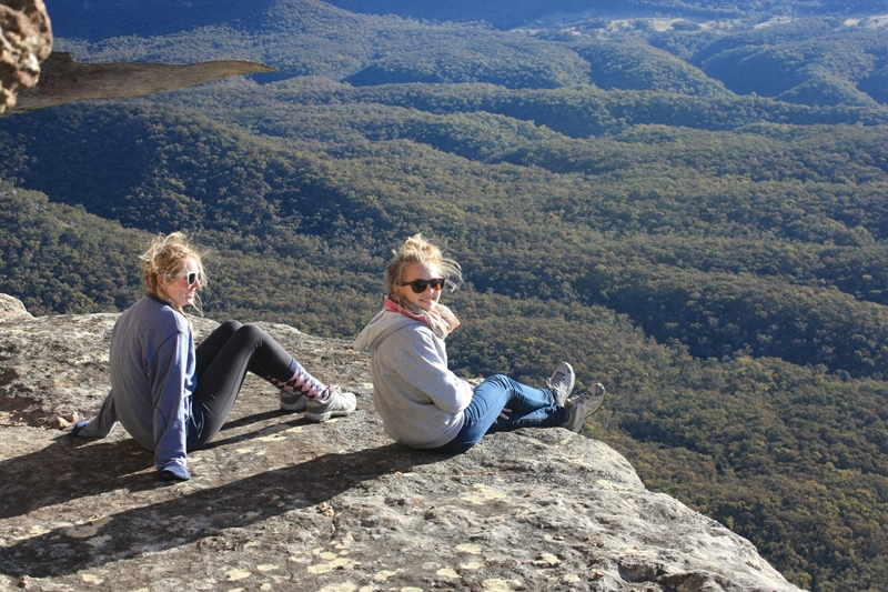
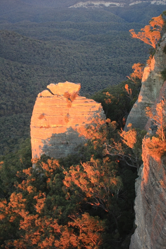
On Pantoneys Crown summit plateau |
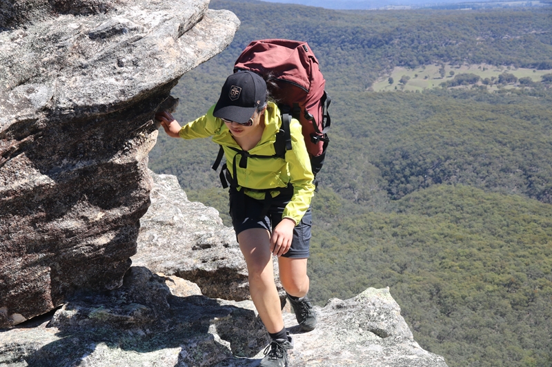
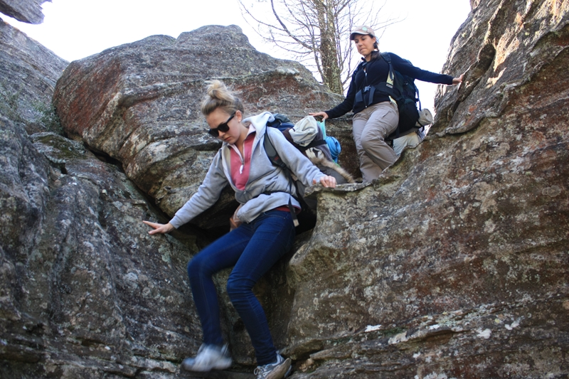
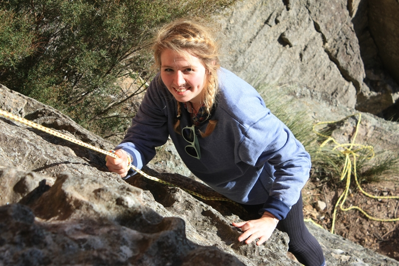
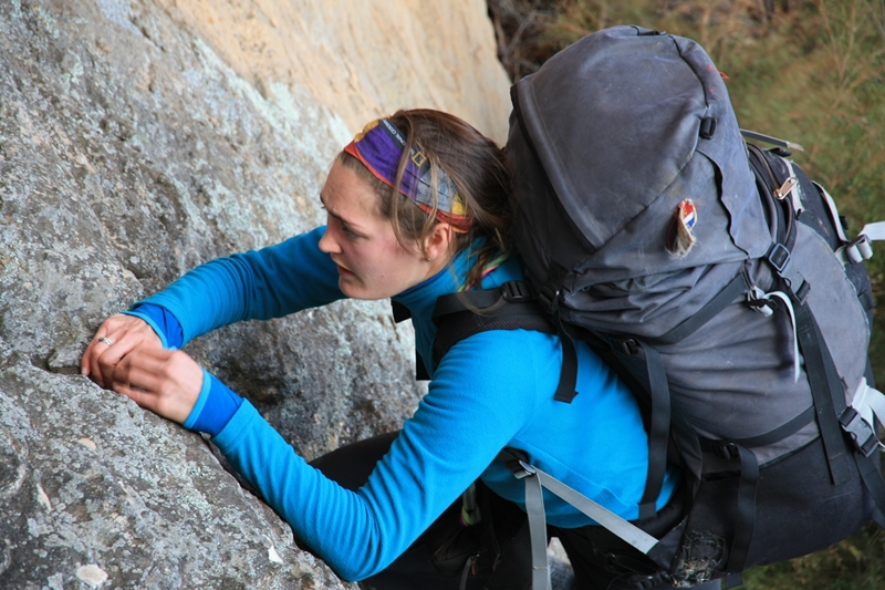
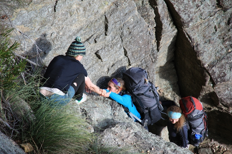
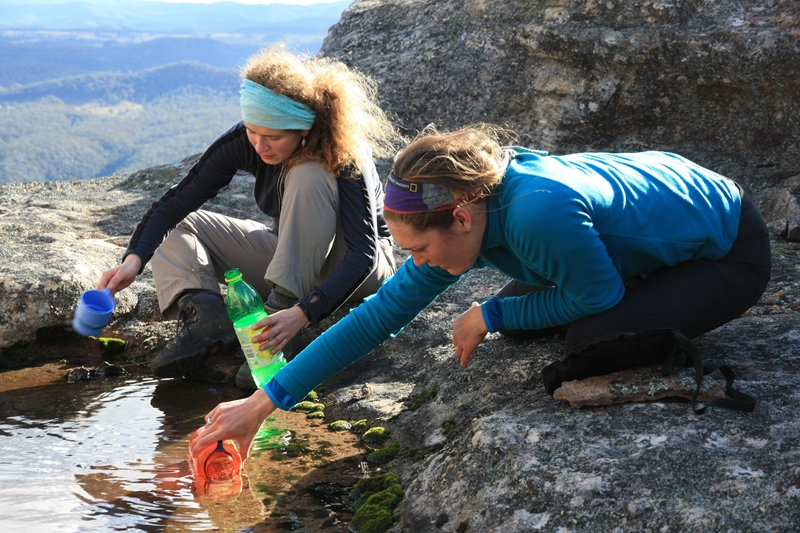
| Day 3 (Saturday) | 9km | 600m | 600m | After enjoying the spectacular sunrise from our high camp we pack up and walk to the northern end of Pantoneys Crown. On our way we reach the summit cairn and there may be an old logbook there. We then reach the northern end of the Crown and find the route down. It is very steep, and starts with a careful downclimb through the cliffs. We will most likely lower packs on a rope. This is followed by an extremely steep descent where great care must be taken. When the descent levels out we must navigate carefully to the correct ridge to reach Crown Creek at the point where we want to cross it for the climb of Point Cameron. Most likely we will have lunch and refill water bottles at Crown Creek. We then have a strenuous climb of Point Cameron, carrying all our water bottles full once more. It gets steeper and steeper until the final extremely steep climb up a loose but exhilarating climb to the top of Point Cameron. Extreme care is required here and rope may be used for safety on the steepest sections. We camp on the top of Point Cameron and from there we enjoy simply stunning views back to Pantoneys Crown and the surrounding majesty of the Capertee Valley. This is our last night camped out on the hike. |
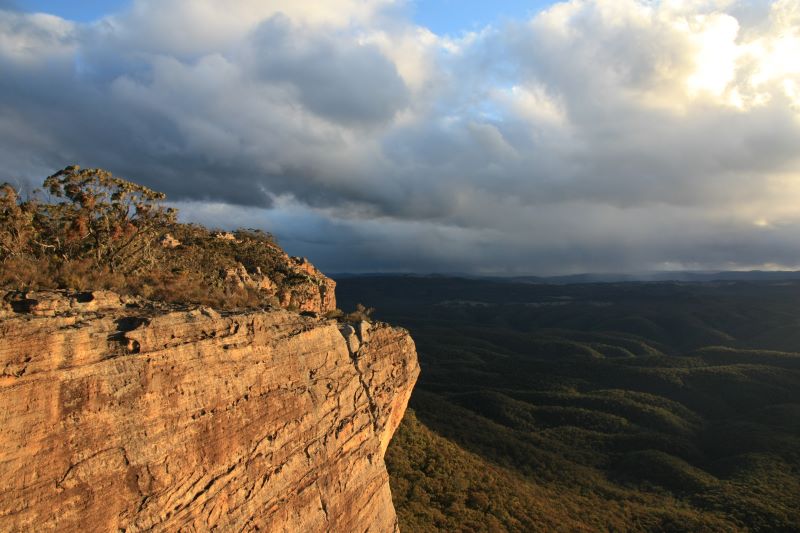
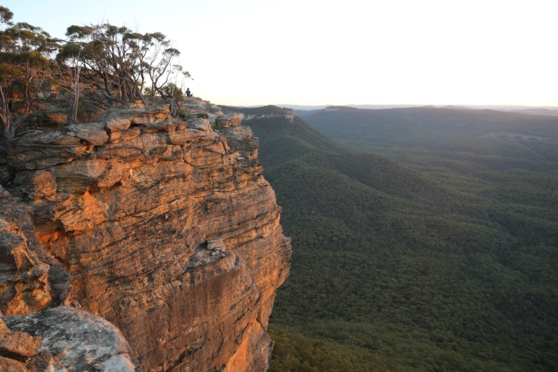
Top of Point Cameron |
| Day 4 (Sunday) | 9km | 200m | 200m | The sunrise from Point Cameron has to be seen to be believed, it will bathe Pantoneys Crown in morning light and from your viewpoint near your tent your camera will be clicking. Today is a shorter day but still very spectacular and varied. From Point Cameron we climb pagodas and walk along the escarpment to McLean Pass which is on the Great Dividing Range. The route there has some very interesting features such as prominent lookout points, and a steep defile that needs to be climbed into and out of. Once on the Great Dividing Range the hiking is gentler until we reach a fire trail leading out to Cape Horn, a prominent lookout over the Wolgan Valley. We may make the short side trip out to Cape Horn for lunch, or we might walk straight back to the cars, depending on time and how much water we have left. Once back at the cars we reverse the process of the first day, driving out along the rough roads in Ben Bullen State Forest, returning to Lithgow where we part company and head our separate ways. |
| Total | 30km | 1400m | 1400m |
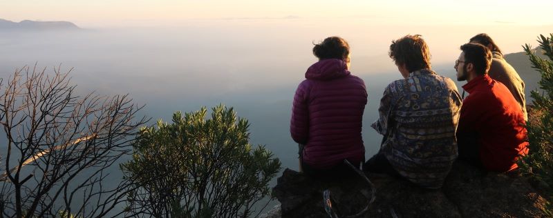
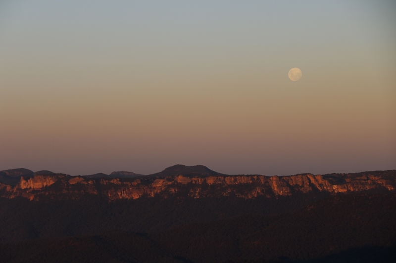
Sunrise from Point Cameron
The elevation chart below gives you a good idea of the amount of climbing and descending each day of the walk. As you can see there are several steep ascents and descents.
Being a self-supported bushwalk, the idea is that everyone brings their own gear and food for the weekend. Click the button below to review the gear list for this trip.
![]()
If you don’t have some of the items on this list, some items such as tent, pack and sleeping pad can be borrowed from MountainSphere Adventures. There may be a small fee for borrowing some items. Alternatively, some items such as tents and cooking equipment can be shared. There is no charge if sharing a tent space with someone else.
The Pantoneys Crown trip is the hardest of all the guided hikes offered in the MountainSphere repertoire. It is also the remotest and farthest to walk to get out in an emergency. The daily distances walked may appear modest but significant time and effort in each of the first two days is invested in negotiating the steep downclimbs and upclimbs.
Even the walk along the dirt road in Ben Bullen State Forest is difficult because the road is extremely steep on the descent to Baal Bone gap and great care must be taken to avoid slipping on the loose gravel. The road is badly eroded, there are deep muddy pools and slippery areas and it is easy to fall.
We must carry all of our water with the only guaranteed water point being Crown Creek in the middle of the second day.
The descent off Baal Bone Point on the first day is extremely steep and exposed and great care must be taken. This is followed by a very steep ascent onto Pantoneys Crown itself, with a section of almost rock climbing where rope and belay are required.
The summit of Pantoneys Crown is relatively level but complex in terrain and scrubby in places.
The descent off the northern end of Pantoneys Crown is again extremely steep with some careful rock scrambling needed followed by extremely steep dirt cliffs that need to be descended with great care.
There is more descending in very steep terrain to Crown Creek and back out again with our packs laden with water. The ascent of Point Cameron is wickedly steep and again extreme care must be taken.
The final day is shorter and easier but not without its challenges with some very steep fissures and saddles needing to be crossed.
By any measure this is a difficult hike and everyone attending must be under no illusions about how difficult it is. I don't give numbered gradings to trips, just expect this to be the hardest trip you have done.
In conclusion, you need to consider the following when assessing in your own mind the level of difficulty of the walk:
You have been warned. This is a hard trip.
Due to the challenging nature of this trip, its remoteness, and the steep climbing passes, this trip is open only to clients who have completed at least two previous MountainSphere trips, with at least one of those previous trips being either the Red Rocks, the K2K or the 3 day navigation weekend. It is not open to those who have only completed the 2 day navigation weekend.
This is to ensure that the trip is a success, is safe, and within the capability of all participants.
Here are a few photos of the walk. These have been selected to promote the spectacular natural beauty of the trip as well as to highlight the challenges you may encounter on the way.
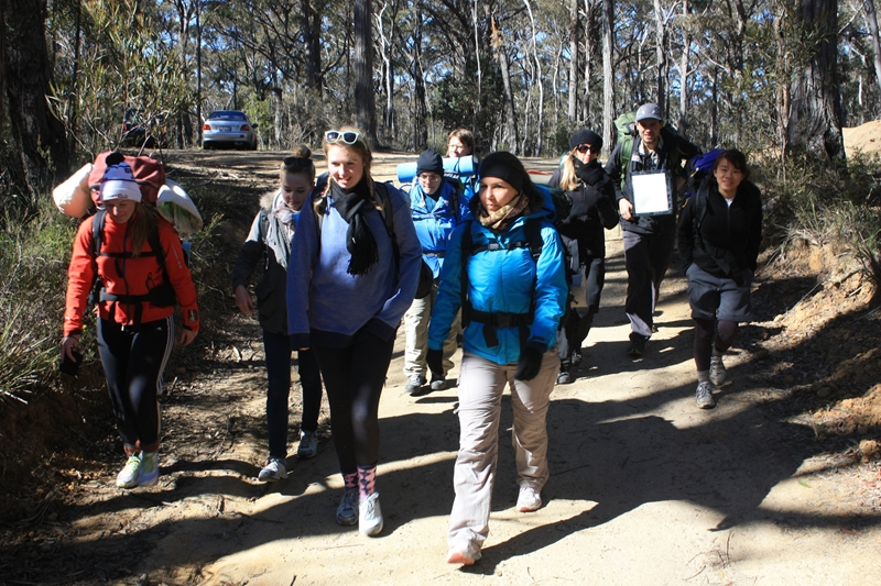 |
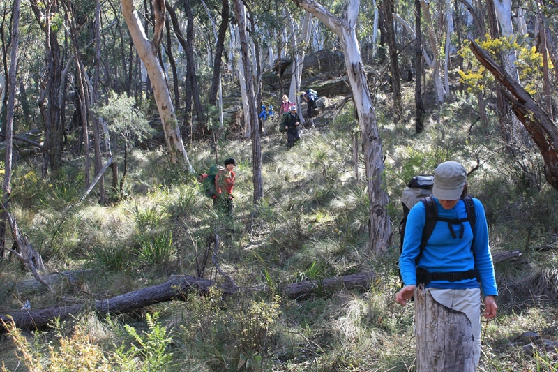
Next morning we set off early on a 4WD trail towards Baal Bone Gap. |
 |
|
 |
|
 |
|
 |
|
 |
|
 |
|
 |
|
 |
|
 |
|
 |
|
 |
|
 |
|
 |
|
 |
|
 |
|
 |
|
 |
|
 |
|
 |
|
 |
|
 |
|
 |
|
 |
|
 |
The size of the group will be capped at 6 clients, and the trip will not proceed unless a minimum number of 4 clients sign up.
$400
The cost includes:
The cost does not include:
![]()
When I receive your application, I will review it and then contact you. I will send you an invoice which when paid will confirm your place on the trip. You will then receive a full information pack containing everything you need to know to prepare for and attend the trip.
Pantoneys Crown guided hikes are currently scheduled for:
| 27-30 May 2021 | COMPLETED! See the photos. |
| 5-8 May 2022 | PLACES AVAILABLE! Apply Now. |
Web page created 30 Mar 2021, last updated 06 Oct 2021. All content copyright © Ashley Burke 2021. Not to be copied, duplicated or used for any purpose without permission. |